
Image Details
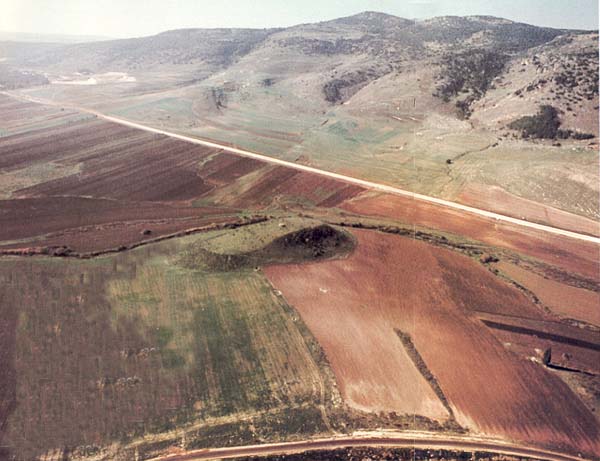
The cultivated fields of the Western Jezreel Valley stretch along the eastern flank of Mt. Carmel, seen in the background. In ancient times, as in the present, armies and traders traversed the Carmel through two passes which link the Mediterranean and the Jezreel Valley. Throughout history settlements have been located in this fertile valley near the Via Maris, the major international route connecting Egypt and Syria-Palestine. One of these settlements, Qashish, has been discovered in the small mound seen in the center of the picture; its excavation is part of a study of several sites and their relationship to one another in the region of the Western Jezreel. The modern highway marks the location of the route of the Via Maris.