
Image Details
Helfried Weyer
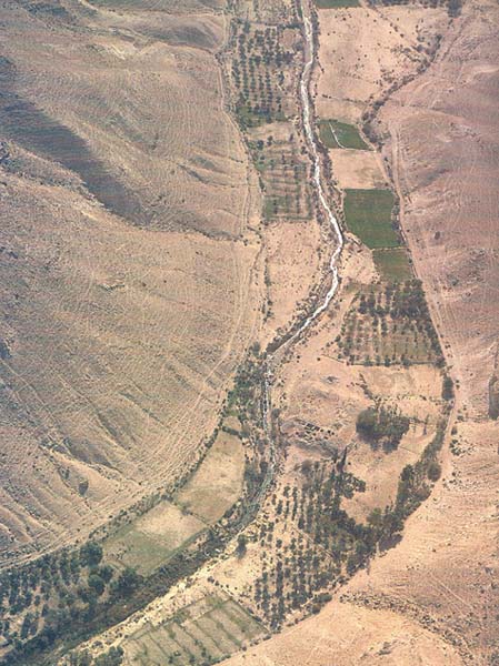
The small stream that serves as the lifeblood of this oasis flows from a spring, one of four springs in the region, at lower center. Tel Kadesh-Barnea (Tell Ein el-Qudeirat), in the open area at center, to the right of the crook in the stream, contains the remains of three fortresses, one atop the other, the earliest dating to the tenth century B.C. Despite the lack of archaeological evidence from the time of the Exodus, generally thought to be at least 300 years earlier, nearly all scholars agree that Ein el-Qudeirat is Kadesh-Barnea, it fits the geographical requirements well, and the name was preserved at a nearby spring called Ein Qadis, where another Israelite fort was discovered by Yohanan Aharoni. No such agreement can be found, however, on the question of how the Israelites got to Kadesh-Barnea—what route they took on the Exodus. In a new examination of this old question, author Itzhaq Beit-Arieh uses ecological and ethnographic clues to trace the Israelites’ most probable route.