
Image Details
Courtesy of Samuel Halperin
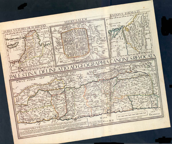
French map of the Holy Land with inserts of the ancient Near East and Jerusalem, published in 1641 by the Parisian mapmaker Pierre Mariette.
The large map portrays the Holy Land oriented on an east-west axis with east toward the top of the map, and divided into the the areas once occupied by the 12 tribes of Israel. The Mediterranean Sea (Mare Magnum) edges the bottom of the map. The Jordan River runs left to right to its terminus in the Mare Mortuum, or Dead Sea. Part of the presumed route of the Exodus, represented by a double dotted line, begins at the right center border of the map (south) and continues east and then north toward Edom on the east bank of the Jordan River. Most place names are in Latin.
Though drawn quite accurately to scale—an improvement over many earlier maps that portrayed Jerusalem as the center of the world and greatly exaggerated the size of the Holy Land—the map lacks many topographical features and includes others that do not exist. Like most mapmakers of his day, Mariette based the locations of many biblical sites on descriptions from the Bible. The first maps based on scientific surveys of the Holy Land were not made until the 19th century.